The popular Elevate web portal and supporting GIS services are part of Schneider Geospatial’s growing suite of parcel management solutions.

The Elevate web portal and the local government consulting practice from 39 Degrees are now a part of Schneider Geospatial.

Benton County, IN
Bartholomew County, IN
Cass County, IN
Clark County, IN
Elkhart County, IN
Floyd County, IN
Grant County, IN
Harrison County, IN
Jay County, IN
Lawrence County, IN
Martin County, IN
Miami County, IN
Monroe County, IN
Morgan County, IN
Orange County, IN
White County, IN

Comprehensive Solutions
With the addition of appraisal modeling, comparable sales, appeals management, and related data-centric applications, Schneider Geospatial can better serve and empower government agencies to leverage smart data and achieve greater efficiency.
Our Solutions
Explore our GIS-integrated tools
Have a question?
Contact our Sales Team
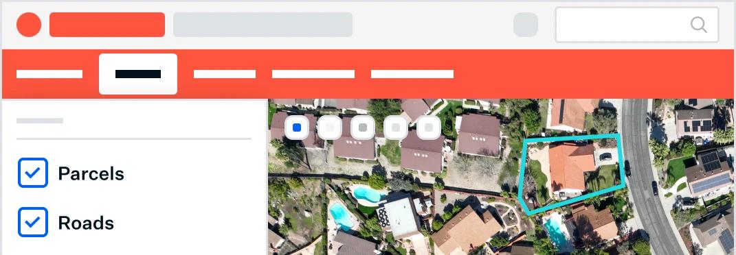
Parcel Management
Integrated information for better decision making and citizen engagement. Our platform integrates with CAMA, Tax Administration, and other systems, giving you unified tools for appraisals, appeals, sales searches, forms, and more.

Permitting & Licensing
Make permits, licenses and applications easily accessible online. Discover affordable solutions for buildings, marriage, construction, electrical, alcohol, and more.


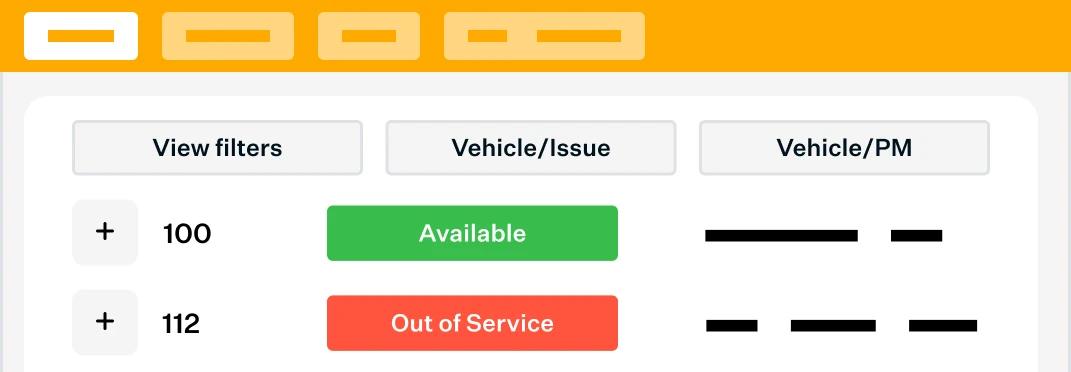
Asset Management
Discover powerful digital tools that make work more accurate and efficient. Find solutions for monitoring and managing fleet, work orders, permits, infrastructure, water systems, and more.
Schedule a 15-minute learning session.
We'll talk with you about best practices for parcel management, and the solutions other local governments are using, so you're fully informed.